| | | | | | |

拐着弯儿的去北极-序

各位请注意:和常客积分里程不相关的旅行文章将不会在这里贴出,所以,想要跟进这长篇游记的朋友请访问我的新浪博客, 原因是,新版的BA博客操作页批量上图异常痛苦。

对于经常坐在飞机上的我来说,最喜欢做的一件事就是对着航空公司杂志上的航线图发呆,发着发着就开始做梦,梦想着哪天我又去哪里了。 突然有那么一天,我相中了中亚,这个去年只短短停留了几天的地方。从中亚接着去哪里呢?地图越来越长,到最后,干脆就决定从中亚一路溜达到朗伊尔城吧,这个位于北极圈内地球上最北端的商业机场。后来我叔叔听说了我的行程,也要连忙参与进来.

这个行程由于中间牵扯到了朗伊尔城,虽然夏天每天都有航班,但有些日期的到达起飞时间非常差,所以一切以朗伊尔城的航班为主中心。

去程长途航班使用的BMI公司的11250里程

中间的11个航段使用的是美联航的32500里程

而回程的长途航班也是使用的BMI公司的18750里程。

陆路的行程包含了乌兹比克斯坦,土库曼斯坦,伊朗,阿塞拜疆(未遂),亚美尼亚和格鲁吉亚,剩下为空路

很多朋友已经知道,上述里飞行兑换里还牵扯到了我后面的一个巴尔干半岛的故事。由于行程的长度过长,只有乌兹别克和最后的朗伊尔城的酒店是提前订好的,剩下的,只能边走边订了。 这二个半月在路上,各种经历不断,大家听我慢慢唐僧吧。

单纯飞行路线

A map of the Northern Hemisphere showing various flight routes. The routes are marked with red lines connecting different cities, which are labeled with their respective airport codes. The cities include ICN (Incheon, South Korea), PEK (Beijing, China), TAS (Tashkent, Uzbekistan), EVN (Yerevan, Armenia), SKP (Skopje, North Macedonia), PRG (Prague, Czech Republic), VIE (Vienna, Austria), BRU (Brussels, Belgium), CPH (Copenhagen, Denmark), OSL (Oslo, Norway), TOS (Tromsø, Norway), and LYR (Longyearbyen, Svalbard, Norway). The map is centered on the North Pole, showing parts of North America, Europe, and Asia.

基本总路线

A satellite map image of Europe and parts of Asia, showing a route marked with green pins labeled with letters from A to V. The route starts in Kyrgyzstan (A) and passes through several countries including Kazakhstan, Russia, Ukraine, Poland, Germany, Denmark, and Norway, ending in Norway (V). The map includes a scale bar indicating distances in miles and kilometers, and options for map and traffic views in the top right corner.

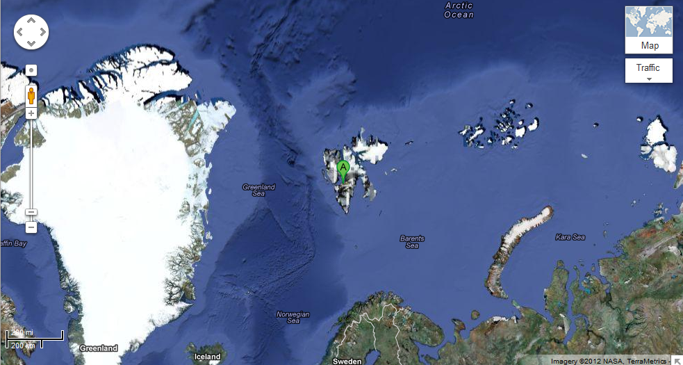
最后的朗伊尔在这里呢

Alt text: A satellite map image showing the northern regions of the Earth, including Greenland, Iceland, and parts of Norway, Sweden, and Russia. The map highlights various seas such as the Greenland Sea, Norwegian Sea, Barents Sea, and Kara Sea. The Arctic Ocean is visible at the top of the image. A marker labeled "A" is placed on an island in the middle of the map. The map interface includes zoom controls and a map/traffic toggle option.

5 Comments

Leave a Reply

Your email address will not be published. Required fields are marked *

This site uses Akismet to reduce spam. Learn how your comment data is processed.